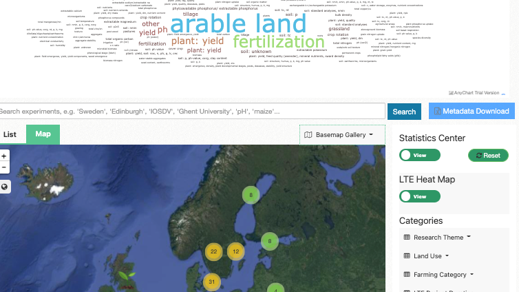
The BonaRes Centre team is pleased to announce that the LTE Overview Map is updated through the provisioning of information on European LTE (metadata) within the BonaRes and EJP SOIL collaboration. The updated map can be found here: lte.bonares.de
LTEs are crucial agricultural research infrastructures for monitoring the long term effects of management and environment on crop production and soil resources. The updated map comprises the enlarged metadata collection by the recent collaboration between the BonaRes (www.bonares.de) and EJP SOIL (www.ejpsoil.eu) groups into the most comprehensive dataset for Europe, providing access to LTE. In this context, the metadata of 616 LTEs from 30 different countries across Europe was compiled (https://doi.org/10.20387/bonares-40kc-2661), including clustered information of the LTEs in different categories (management operations, land use, duration, status, etc.). The overview map illustrates 532 European LTEs after filtering a minimum duration of 20 years based on the BonaRes standards.
The users can discover LTEs on the map and download their metadata, including research themes, fertilization, crop rotation and tillage treatments, in a PDF format.
 The BonaRes Repository Team